GPS-denied visual autonomy
Software-first visual positioning for drones operating in GPS-denied environments.


Our mission is to keep humans far from the battlefield.

EW is standard. Mission failure cannot be. Theseus gives drones reliable position when GPS is jammed, spoofed, or gone.
Cyclops is software-only visual positioning built to integrate fast, hold up across terrain and lighting, and deploy at scale.
Cyclops
Software-first visual positioning
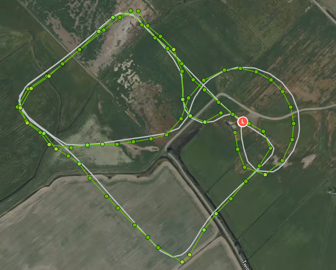
Cyclops compares live camera imagery against pre-generated reference maps to estimate vehicle position in real time. It outputs positions to the flight controller over standard MAVLink interfaces.
GPS-denied positioning
Reliable global position estimates when GPS is jammed, spoofed, or unavailable. Outputs over MAVLink for straightforward flight-controller integration.
Day and night
Cyclops is compatible with EO and LWIR cameras. Fly thermal at night, EO during the day.
Fast Integration
Typical integration starts with a short bench setup and validation flights, letting teams evaluate Cyclops quickly without major hardware changes.
Commodity hardware
Runs on NDAA-compliant, widely available compute and camera hardware, including platforms like Raspberry Pi 5 and Nvidia Jetson.

built for
Integrate GPS-denied positioning without building a new stack.
\ ArduPilot-native / MAVLink
\ Commodity compute and camera hardware
\ Scales without exotic sensors
Field reliable GPS-denied capability across fleets.
\ Resilient in contested environments
\ Low SWaP-C deployment model
\ Made in America, compliant, and scalable

Keep flying when GPS fails.
\ Dependable position in denied environments
\ EO by day, thermal by night
\ Lower cognitive load, higher mission continuity
